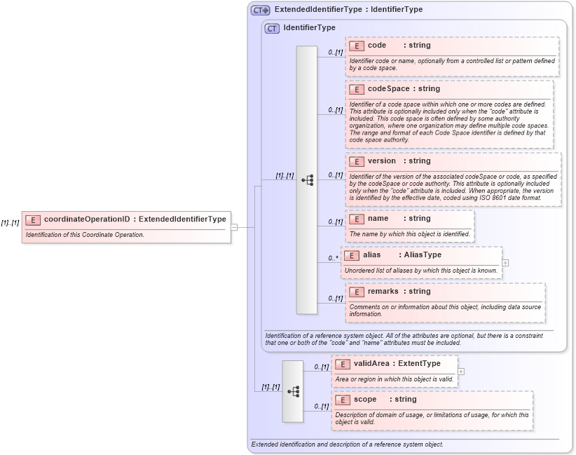
Definition Type: Element
Name: coordinateOperationID
Namespace: http://www.opengis.net/gml
Type: gml:ExtendedIdentifierType
Containing Schema: coordinateOperations.xsd
MinOccurs (1)
MaxOccurs (1)
Abstract
Documentation:
Identification of this Coordinate Operation.
Collapse XSD Schema Diagram:
Drilldown into scope in schema referencesystems_xsd Drilldown into validArea in schema referencesystems_xsd Drilldown into remarks in schema referencesystems_xsd Drilldown into alias in schema referencesystems_xsd Drilldown into name in schema referencesystems_xsd Drilldown into version in schema referencesystems_xsd Drilldown into codeSpace in schema referencesystems_xsd Drilldown into code in schema referencesystems_xsd Drilldown into IdentifierType in schema referencesystems_xsd Drilldown into ExtendedIdentifierType in schema referencesystems_xsdXSD Diagram of coordinateOperationID in schema coordinateoperations_xsd (Geography Markup Language)
Collapse XSD Schema Code:
<element name="coordinateOperationID" type="gml:ExtendedIdentifierType">
    <annotation>
        <documentation>Identification of this Coordinate Operation. </documentation>
    </annotation>
</element>
Collapse Child Elements:
Name Type Min Occurs Max Occurs
code gml:code 0 (1)
codeSpace gml:codeSpace 0 (1)
version gml:version 0 (1)
name gml:name 0 (1)
alias gml:alias 0 unbounded
remarks gml:remarks 0 (1)
validArea gml:validArea 0 (1)
scope gml:scope 0 (1)
Collapse Derivation Tree: