<xsd:simpleType name="DerivedCRSTypeType" xmlns:xsd="http://www.w3.org/2001/XMLSchema">
<xsd:annotation>
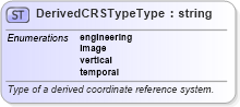
<xsd:documentation>Type of a derived coordinate reference system. </xsd:documentation>
</xsd:annotation>
<xsd:restriction base="string">
<xsd:enumeration value="engineering">
<xsd:annotation>
<xsd:documentation>A contextually local coordinate reference system; which can be divided into two broad categories:
- earth-fixed systems applied to engineering activities on or near the surface of the earth;
- CRSs on moving platforms such as road vehicles, vessels, aircraft, or spacecraft. </xsd:documentation>
</xsd:annotation>
</xsd:enumeration>
<xsd:enumeration value="image">
<xsd:annotation>
<xsd:documentation>An engineering coordinate reference system applied to locations in images. </xsd:documentation>
</xsd:annotation>
</xsd:enumeration>
<xsd:enumeration value="vertical">
<xsd:annotation>
<xsd:documentation>A coordinate reference system used for recording of heights or depths. Vertical CRSs make use of the direction of gravity to define the concept of height or depth, but the relationship with gravity may not be straightforward. </xsd:documentation>
</xsd:annotation>
</xsd:enumeration>
<xsd:enumeration value="temporal">
<xsd:annotation>
<xsd:documentation>A coordinate reference system used for the recording of time. </xsd:documentation>
</xsd:annotation>
</xsd:enumeration>
</xsd:restriction>
</xsd:simpleType>
|