<xsd:simpleType name="VerticalDatumTypeType" xmlns:xsd="http://www.w3.org/2001/XMLSchema">
<xsd:annotation>
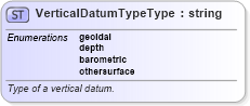
<xsd:documentation>Type of a vertical datum.</xsd:documentation>
</xsd:annotation>
<xsd:restriction base="string">
<xsd:enumeration value="geoidal">
<xsd:annotation>
<xsd:documentation>The zero value of the associated vertical coordinate system axis is defined to approximate a constant potential surface, usually the geoid. Such a reference surface is usually determined by a national or scientific authority, and is then a well-known, named datum. </xsd:documentation>
</xsd:annotation>
</xsd:enumeration>
<xsd:enumeration value="depth">
<xsd:annotation>
<xsd:documentation>The zero point of the vertical axis is defined by a surface that has meaning for the purpose which the associated vertical measurements are used for. For hydrographic charts, this is often a predicted nominal sea surface (i.e. without waves or other wind and current effects) that occurs at low tide. For some examples, see OGC Abstract Specification Topic 2. </xsd:documentation>
</xsd:annotation>
</xsd:enumeration>
<xsd:enumeration value="barometric">
<xsd:annotation>
<xsd:documentation>Atmospheric pressure is the basis for the definition of the origin of the associated vertical coordinate system axis. For more information, see OGC Abstract Specification Topic 2. </xsd:documentation>
</xsd:annotation>
</xsd:enumeration>
<xsd:enumeration value="othersurface">
<xsd:annotation>
<xsd:documentation>In some cases, e.g. oil exploration and production, a geological feature, such as the top or bottom of a geologically identifiable and meaningful subsurface layer, is used as a vertical datum. Other variations to the above three vertical datum types may exist and are all included in this type. </xsd:documentation>
</xsd:annotation>
</xsd:enumeration>
</xsd:restriction>
</xsd:simpleType>
|