Definition Type: Element
Name: validArea
Namespace: http://www.opengis.net/gml
Type: gml:ExtentType
Containing Schema: referenceSystems.xsd
Abstract
Documentation:
Area or region in which this CRS object is valid.
Collapse XSD Schema Diagram:
Drilldown into temporalExtent in schema referencesystems_xsd Drilldown into verticalExtent in schema referencesystems_xsd Drilldown into boundingPolygon in schema referencesystems_xsd Drilldown into boundingBox in schema referencesystems_xsd Drilldown into description in schema gmlbase_xsd Drilldown into ExtentType in schema referencesystems_xsdXSD Diagram of validArea in schema referencesystems_xsd (Geography Markup Language)
Collapse XSD Schema Code:
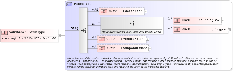
<element name="validArea" type="gml:ExtentType">
    <annotation>
        <documentation>Area or region in which this CRS object is valid. </documentation>
    </annotation>
</element>
Collapse Child Elements:
Name Type Min Occurs Max Occurs
description gml:description 0 (1)
boundingBox gml:boundingBox 0 unbounded
boundingPolygon gml:boundingPolygon 0 unbounded
verticalExtent gml:verticalExtent 0 unbounded
temporalExtent gml:temporalExtent 0 unbounded
Collapse Derivation Tree: