Definition Type: Element
Name: DerivedCRS
Namespace: http://www.opengis.net/gml/3.2
Type: gml:DerivedCRSType
Containing Schema: coordinateReferenceSystems.xsd
Abstract
Documentation:
gml:DerivedCRS is a single coordinate reference system that is defined by its coordinate conversion from another single coordinate reference system known as the base CRS. The base CRS can be a projected coordinate reference system, if this DerivedCRS is used for a georectified grid coverage as described in ISO 19123, Clause 8.
Collapse XSD Schema Diagram:
Drilldown into coordinateSystem in schema coordinatereferencesystems_xsd Drilldown into derivedCRSType in schema coordinatereferencesystems_xsd Drilldown into baseCRS in schema coordinatereferencesystems_xsd Drilldown into conversion in schema coordinatereferencesystems_xsd Drilldown into scope in schema referencesystems_xsd Drilldown into domainOfValidity in schema referencesystems_xsd Drilldown into remarks in schema dictionary_xsd Drilldown into name in schema gmlbase_xsd Drilldown into identifier in schema gmlbase_xsd Drilldown into descriptionReference in schema gmlbase_xsd Drilldown into description in schema gmlbase_xsd Drilldown into metaDataProperty in schema deprecatedtypes_xsd Drilldown into StandardObjectProperties in schema gmlbase_xsd Drilldown into id in schema gmlbase_xsd Drilldown into DefinitionBaseType in schema dictionary_xsd Drilldown into DefinitionType in schema dictionary_xsd Drilldown into IdentifiedObjectType in schema referencesystems_xsd Drilldown into AbstractCRSType in schema referencesystems_xsd Drilldown into AbstractGeneralDerivedCRSType in schema coordinatereferencesystems_xsd Drilldown into DerivedCRSType in schema coordinatereferencesystems_xsdXSD Diagram of DerivedCRS in schema coordinatereferencesystems_xsd (Geography Markup Language)
Collapse XSD Schema Code:
<element name="DerivedCRS" type="gml:DerivedCRSType" substitutionGroup="gml:AbstractGeneralDerivedCRS">
    <annotation>
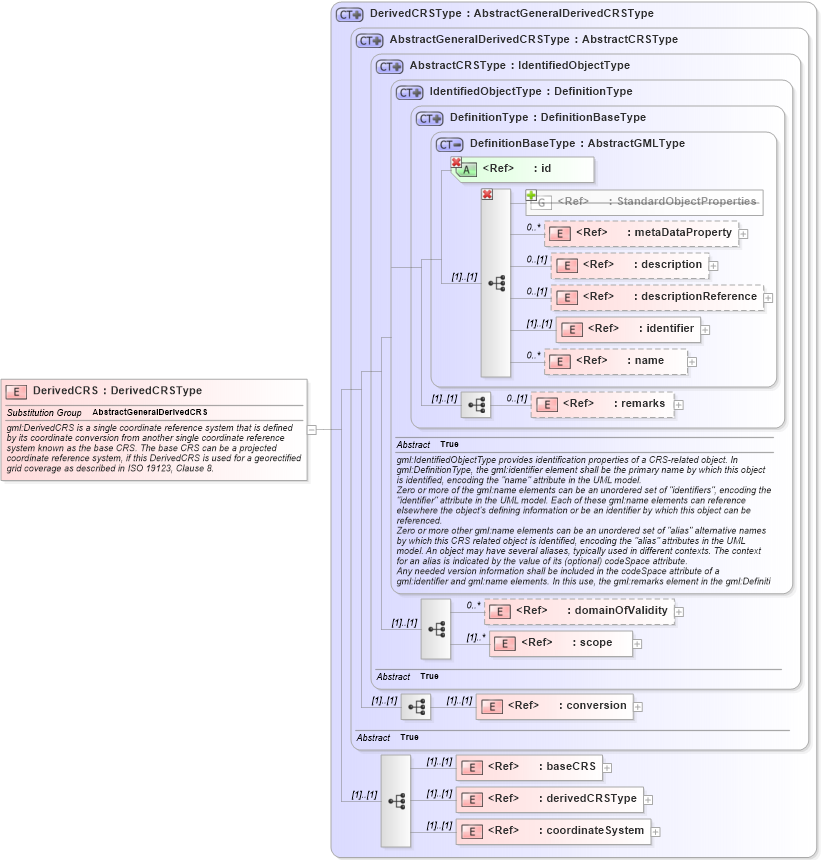
        <documentation>gml:DerivedCRS is a single coordinate reference system that is defined by its coordinate conversion from another single coordinate reference system known as the base CRS. The base CRS can be a projected coordinate reference system, if this DerivedCRS is used for a georectified grid coverage as described in ISO 19123, Clause 8.</documentation>
    </annotation>
</element>
Collapse Child Elements:
Name Type Min Occurs Max Occurs
metaDataProperty gml:metaDataProperty 0 unbounded
description gml:description 0 (1)
descriptionReference gml:descriptionReference 0 (1)
identifier gml:identifier 0 (1)
name gml:name 0 unbounded
metaDataProperty gml:metaDataProperty 0 unbounded
description gml:description 0 (1)
descriptionReference gml:descriptionReference 0 (1)
identifier gml:identifier (1) (1)
name gml:name 0 unbounded
remarks gml:remarks 0 (1)
domainOfValidity gml:domainOfValidity 0 unbounded
scope gml:scope (1) unbounded
conversion gml:conversion (1) (1)
baseCRS gml:baseCRS (1) (1)
derivedCRSType gml:derivedCRSType (1) (1)
coordinateSystem gml:coordinateSystem (1) (1)
<xs:group> gml:StandardObjectProperties (1) (1)
Collapse Child Attributes:
Name Type Default Value Use
id gml:id Required
Collapse Derivation Tree:
Collapse References:
gml:AbstractGeneralDerivedCRS