| Definition Type: | Element |
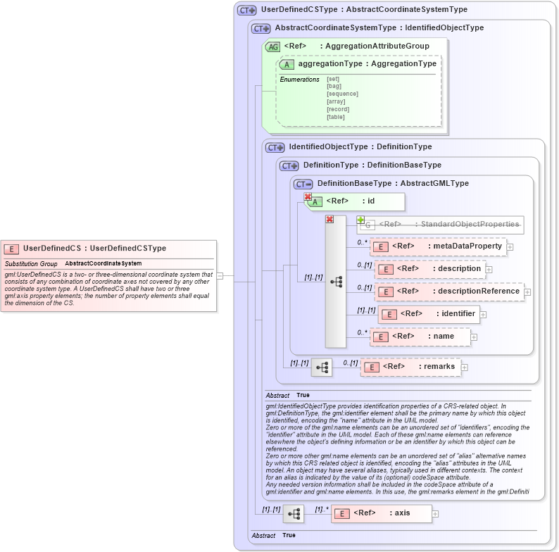
| Name: | UserDefinedCS |
| Namespace: | http://www.opengis.net/gml/3.2 |
| Type: | gml:UserDefinedCSType |
| Containing Schema: | coordinateSystems.xsd |
| Abstract | |
| Documentation: |
gml:UserDefinedCS is a two- or three-dimensional coordinate system that consists of
any combination of coordinate axes not covered by any other coordinate system type.
A UserDefinedCS shall have two or three gml:axis property elements; the number of
property elements shall equal the dimension of the CS.
|
|
|
|
|||||||||||||||||||||||||||||||||||||||||||||||||||||||||
|
|||||||||||||
| gml:AbstractCoordinateSystem | |