<xs:element name="CgPoint">
<xs:annotation>
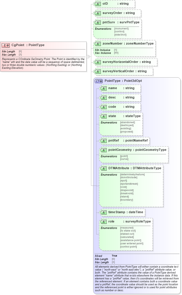
<xs:documentation>Represents a COrdinate GeOmetry Point. The Point is identified by the "name" attr and the data value will be a sequence of space delimented, two or three double numberic values: (Northing Easting) or (Northing Easting Elevation).</xs:documentation>
</xs:annotation>
<xs:complexType mixed="true">
<xs:simpleContent>
<xs:extension base="PointType">
<xs:attribute name="oID" type="xs:string" />
<xs:attribute name="surveyOrder" type="xs:string" />
<xs:attribute name="pntSurv" type="survPntType" />
<xs:attribute name="zoneNumber" type="zoneNumberType" />
<xs:attribute name="surveyHorizontalOrder" type="xs:string" />
<xs:attribute name="surveyVerticalOrder" type="xs:string" />
</xs:extension>
</xs:simpleContent>
</xs:complexType>
</xs:element>
|