Definition Type: Element
Name: PntList2D
Namespace: http://www.landxml.org/schema/LandXML-1.1
Type: land:Point
Containing Schema: LandXML-1.1.xsd
Abstract
ContentType Restriction
Documentation:
A sequential space delimited list of 2D coordinates with a minimum of 2 points (4 values). It is primarily used for ProfileSurf to hold the list of station/elevations and CrossSectSurf for offset/elevation. Example: "0.000 86.52 6.267 86.89 12.413 87.01 26.020 87.83"
Collapse XSD Schema Diagram:
XSD Diagram of PntList2D in schema landxml-1_1_xsd (National Information Exchange Model (NEIM))
Collapse XSD Schema Code:
<xs:element name="PntList2D">
    <xs:annotation>
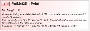
        <xs:documentation>A sequential space delimited list of 2D coordinates with a minimum of 2 points (4 values). </xs:documentation>
        <xs:documentation>It is primarily used for ProfileSurf to hold the list of station/elevations and CrossSectSurf for offset/elevation. </xs:documentation>
        <xs:documentation>Example: "0.000 86.52 6.267 86.89 12.413 87.01 26.020 87.83" </xs:documentation>
    </xs:annotation>
    <xs:simpleType>
        <xs:restriction base="Point">
            <xs:minLength value="2" />
        </xs:restriction>
    </xs:simpleType>
</xs:element>
Collapse Facets:
Facet Value
MinLength 2
Collapse Derivation Tree: