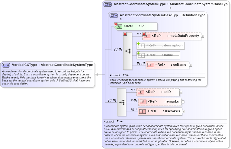
<complexType name="VerticalCSType">
    <annotation>
        <documentation>A one-dimensional coordinate system used to record the heights (or depths) of points. Such a coordinate system is usually dependent on the Earth's gravity field, perhaps loosely as when atmospheric pressure is the basis for the vertical coordinate system axis. A VerticalCS shall have one usesAxis association. </documentation>
    </annotation>
    <complexContent>
        <extension base="gml:AbstractCoordinateSystemType" />
    </complexContent>
</complexType>
|