<xsd:complexType name="GeographicCRSType" xmlns:xsd="http://www.w3.org/2001/XMLSchema">
<xsd:annotation>
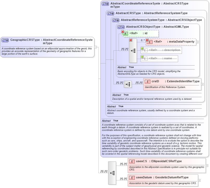
<xsd:documentation>A coordinate reference system based on an ellipsoidal approximation of the geoid; this provides an accurate representation of the geometry of geographic features for a large portion of the earth's surface.</xsd:documentation>
</xsd:annotation>
<xsd:complexContent>
<xsd:extension base="gml:AbstractCoordinateReferenceSystemType">
<xsd:sequence>
<xsd:element name="usesCS" type="gml:EllipsoidalCSRefType">
<xsd:annotation>
<xsd:documentation>Association to the ellipsoidal coordinate system used by this geographic CRS. </xsd:documentation>
</xsd:annotation>
</xsd:element>
<xsd:element name="usesDatum" type="gml:GeodeticDatumRefType">
<xsd:annotation>
<xsd:documentation>Association to the geodetic datum used by this geographic CRS. </xsd:documentation>
</xsd:annotation>
</xsd:element>
</xsd:sequence>
</xsd:extension>
</xsd:complexContent>
</xsd:complexType>
|