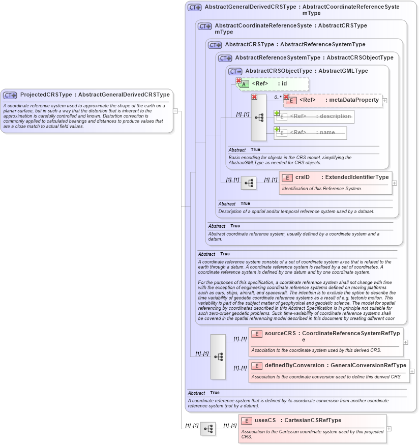
<xsd:complexType name="ProjectedCRSType" xmlns:xsd="http://www.w3.org/2001/XMLSchema">
    <xsd:annotation>
        <xsd:documentation>A coordinate reference system used to approximate the shape of the earth on a planar surface, but in such a way that the distortion that is inherent to the approximation is carefully controlled and known. Distortion correction is commonly applied to calculated bearings and distances to produce values that are a close match to actual field values. </xsd:documentation>
    </xsd:annotation>
    <xsd:complexContent>
        <xsd:extension base="gml:AbstractGeneralDerivedCRSType">
            <xsd:sequence>
                <xsd:element name="usesCS" type="gml:CartesianCSRefType">
                    <xsd:annotation>
                        <xsd:documentation>Association to the Cartesian coordinate system used by this projected CRS. </xsd:documentation>
                    </xsd:annotation>
                </xsd:element>
            </xsd:sequence>
        </xsd:extension>
    </xsd:complexContent>
</xsd:complexType>
|