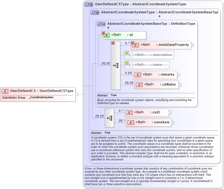
Definition Type: Element
Name: UserDefinedCS
Namespace: http://www.opengis.net/gml
Type: gml:UserDefinedCSType
Containing Schema: coordinateSystems.xsd
Abstract
Collapse XSD Schema Diagram:
Drilldown into usesAxis in schema coordinatesystems_xsd Drilldown into csID in schema coordinatesystems_xsd Drilldown into csName in schema coordinatesystems_xsd Drilldown into remarks in schema referencesystems_xsd Drilldown into name in schema gmlbase_xsd Drilldown into description in schema gmlbase_xsd Drilldown into metaDataProperty in schema gmlbase_xsd Drilldown into id in schema gmlbase_xsd Drilldown into AbstractCoordinateSystemBaseType in schema coordinatesystems_xsd Drilldown into AbstractCoordinateSystemType in schema coordinatesystems_xsd Drilldown into UserDefinedCSType in schema coordinatesystems_xsdXSD Diagram of UserDefinedCS in schema coordinatesystems_xsd (Geography Markup Language)
Collapse XSD Schema Code:
<element name="UserDefinedCS" type="gml:UserDefinedCSType" substitutionGroup="gml:_CoordinateSystem" />
Collapse Child Elements:
Name Type Min Occurs Max Occurs
metaDataProperty gml:metaDataProperty 0 unbounded
description gml:description 0 (1)
name gml:name 0 unbounded
metaDataProperty gml:metaDataProperty 0 unbounded
description gml:description 0 (1)
name gml:name (1) unbounded
metaDataProperty gml:metaDataProperty 0 unbounded
remarks gml:remarks 0 (1)
csName gml:csName (1) (1)
csID gml:csID 0 unbounded
usesAxis gml:usesAxis (1) unbounded
Collapse Child Attributes:
Name Type Default Value Use
id gml:id Required
Collapse Derivation Tree:
Collapse References:
gml:_CoordinateSystem