<xsd:complexType name="ImageCRSType" xmlns:xsd="http://www.w3.org/2001/XMLSchema">
<xsd:annotation>
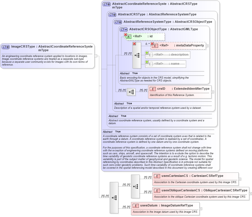
<xsd:documentation>An engineering coordinate reference system applied to locations in images. Image coordinate reference systems are treated as a separate sub-type because a separate user community exists for images with its own terms of reference. </xsd:documentation>
</xsd:annotation>
<xsd:complexContent>
<xsd:extension base="gml:AbstractCoordinateReferenceSystemType">
<xsd:sequence>
<xsd:choice>
<xsd:element name="usesCartesianCS" type="gml:CartesianCSRefType">
<xsd:annotation>
<xsd:documentation>Association to the Cartesian coordinate system used by this image CRS.</xsd:documentation>
</xsd:annotation>
</xsd:element>
<xsd:element name="usesObliqueCartesianCS" type="gml:ObliqueCartesianCSRefType">
<xsd:annotation>
<xsd:documentation>Association to the oblique Cartesian coordinate system used by this image CRS.</xsd:documentation>
</xsd:annotation>
</xsd:element>
</xsd:choice>
<xsd:element name="usesDatum" type="gml:ImageDatumRefType">
<xsd:annotation>
<xsd:documentation>Association to the image datum used by this image CRS. </xsd:documentation>
</xsd:annotation>
</xsd:element>
</xsd:sequence>
</xsd:extension>
</xsd:complexContent>
</xsd:complexType>
|